Geological Modeling Software
Manage Drillholes. Model Domains. Estimate Grades.
Turn drillhole data into defensible geological domains and grade estimates. Validate data on import, build implicit or explicit domains, run variogram modeling, and estimate grades with Ordinary, Simple, and Lognormal Kriging, IDW, or RBF. Cross-validate outputs before handing off domains and block models to downstream mine planning. Request a demo to review the workflow on your deposit.
 Download Presentation
 Model Domains Faster
Create domains with implicit surfaces or explicit wireframing. Update interpretations quickly as drilling and mapping data changes.
Keep One Source of Truth
Work from a centralized drillhole database with permission controls, multi-user access, and consistent data across teams and sites.
Prevent Bad Data From Spreading
Run automatic validation across 12 common error types so issues are fixed before they impact modeling and estimation.
Defend Your Estimates
Build variograms, define anisotropy, and estimate grades with Kriging, IDW, or RBF. Use cross-validation and confidence-based resource categorization.
Interpret Geological Domains
Build geological domains using implicit surfaces or explicit wireframing so your 3D geological modeling stays consistent as drilling evolves. Update boundaries when new intervals arrive, then carry domains directly into estimation and block modeling workflows.
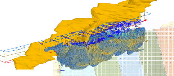
Build Block Models
Create cubic, sub-blocked, or seam block models with flexible rotation and origin settings. Set block sizes appropriate for your deposit and mining method, then populate blocks with geological codes, grades, and density. Apply domain constraints so interpolation stays inside geologic boundaries and results are easier to audit and explain.
- Cubic models for standard deposits and reporting
- Sub-blocking and reblocking to refine resolution where needed
- Seam models with variable thickness for stratified deposits
- Direct database connection to composite assay tables
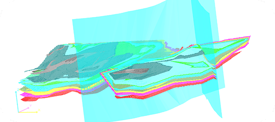
Model Stratigraphy and Seams
Build layered geological models for stratiform deposits. Define seam geometry with roof, floor, and internal partings, then handle structural complexity such as faults, folds, and pinch-outs. Generate structure contour and thickness (isopach) outputs to support interpretation and downstream modeling.
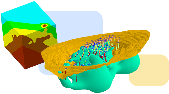
Create Domains With Implicit and Explicit Modeling
Use implicit modeling to generate domain surfaces directly from drillhole data, or build explicit wireframes when you need manual control. Combine both approaches in one project: iterate quickly with implicit domains, then lock down final boundaries with explicit solids. Update models as new drilling arrives so domains stay aligned with the latest data.
- Categorical domain modeling for lithology and alteration
- Fault and structural surfaces to represent discontinuities
- Vein models with hanging wall and footwall solids
- Numerical models to support automated wireframe creation
Analyze Geostatistics and Estimate Resources
Move from experimental variograms to validated grade estimates with clear parameters you can defend. Model theoretical variograms (Linear, Spherical, and Combined), define anisotropy ellipsoids, and run cross-validation to confirm estimates before reporting.

Estimate Grades and Classify Resources
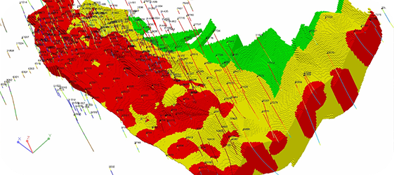
Estimate grades using Ordinary, Simple, and Lognormal Kriging, as well as IDW and RBF interpolation. Configure search ellipses, variogram models, drift options (No Drift, Constant, Linear), and estimation parameters by domain. Run cross-validation to quantify performance and apply percentile-based outlier treatment (hurricane grades) where appropriate.
Validate Data and QA/QC
Validate drillhole data using 12 built-in checks such as collar location issues, survey deviations, interval overlaps, and missing assays. Review errors in list view or on the map so your team can correct issues quickly. Track QA/QC samples (standards, blanks, duplicates) and review trends before you commit to interpretation and estimation.
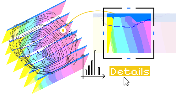
Create Sections and Projections
Generate cross-sections with drillhole traces, geology, and block model grades. Build fence diagrams and long sections to validate continuity and domain logic. Project drillhole data onto section planes with configurable projection distances, then export sections for reports and presentations.

Import and Manage Data
Bring drillhole and geology data in from Excel, Access, CSV, and LAS. Exchange 3D objects via DXF, STR, DM, DAT, DTM, and 3DS formats. Load georeferenced images of geology maps and sections as reference layers for interpretation.
Manage the Drillhole Database
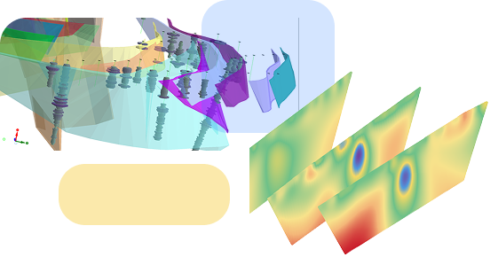
Store drillhole data in a centralized PostgreSQL database built for multi-user work. Choose CSA (Collars-Survey-Assay) for simpler projects or CSLAC (Collars-Survey-Lithology-Assay-Cross Assay) for more complex deposits. Import from CSV or Excel, validate during loading, and standardize custom fields with lookup tables so geology and estimation teams work from consistent definitions.
Generate Maps and Surfaces
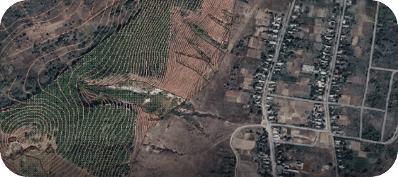
Create structure contour, thickness (isopach), and grade distribution maps to support interpretation and review. Generate surfaces from drillhole contacts or interpretation polylines, then overlay outputs on imagery or topography. Export georeferenced images for GIS workflows and reporting packages.
Prepare Resource Reports
Generate resource summaries with tonnage and grade by category, domain, and elevation. Export block models, estimation settings, and validation outputs so reviewers can reproduce and audit results. Support workflows for NI 43-101, JORC, and SK-1300 documentation.








We offer Mining Consulting!
K-MINE combines deep engineering experience with advanced software capabilities, helping mining companies improve operational performance and profitability.
Frequently Asked Questions
K-MINE Geology uses PostgreSQL with two schema options: CSA (Collars-Survey-Assay) and CSLAC (Collars-Survey-Lithology-Assay-Cross Assay). It supports multi-user access with permission controls.
Cubic, sub-blocked, and seam block models are supported. You can reblock and sub-block to match deposit complexity, mining method, and reporting needs.
Implicit modeling generates domain surfaces automatically from drillhole data. You can build categorical domains for lithology, create structural surfaces (for example, faults), and update surfaces automatically when new drilling data is added.
Automatic drillhole database validation detects 12 common error types such as collar issues, survey problems, interval overlaps, and missing assays. For estimation, use cross-validation and domain-by-domain checks to confirm model behavior.
Yes. You can build stratigraphic interpretations and seam geometry (roof, floor, and partings), handle faults and folds, and generate contour and isopach outputs to support seam block modeling.
Ordinary Kriging, Simple Kriging, Lognormal Kriging, IDW, and RBF are supported. You can define variogram models, anisotropy parameters, and search ellipses, then classify resources by confidence rules.
K-MINE supports resource categorization and report preparation for NI 43-101, JORC, and SK-1300 workflows. Export block models and estimation parameters for third-party review. Competent person sign-off typically requires separate consulting services.
Request a Demo
See how this module can help your mining operations.