Underground Mine Surveying Software
Digitize Workings. Calculate Volumes. Track Development.
Turn underground survey measurements into 3D workings, volumes, and reconciliation outputs. Import directly from Sokkia, Leica, Topcon, and Trimble instruments, then compute tacheometric surveys, theodolite traverses, and leveling with automatic accuracy checks. Digitize drifts, crosscuts, raises, and stopes, compare as-built to design, and report extracted ore volumes by level, stope, and period.
Import From Field Instruments
Bring in measurements from Sokkia, Leica, Topcon, and Trimble, with custom templates for other formats.
Digitize Workings in 3D
Convert survey measurements into 3D models of development and stopes for as-built tracking.
Reconcile Ore Volumes
Calculate extracted volumes from surveys and compare to block model estimates for reconciliation.
Produce Audit-Ready Reports
Generate surveying journals and technical reports from templates and share standardized outputs.
Import Survey Data
Import measurement data directly from total stations and GNSS receivers. Supported formats include Sokkia SDR, Leica GSI and IDEX, Topcon GTS-7, Trimble DC, and Nikon DTM. Create custom import templates for other formats when needed.
Review imported points, check codes and coordinate quality, and filter by point type or survey date before processing.
Digitize Mine Workings
Convert survey measurements into 3D models of underground excavations. Build wireframes for drifts, crosscuts, raises, and stopes from surveyed points and profiles.
Use section templates to maintain consistent cross-sections along headings, then connect sections into solids that support accurate volume calculations and as-built tracking.
Support Daily Underground Surveying
Update excavation models as development advances, calculate period volumes, and generate reports that support grade control and reconciliation.
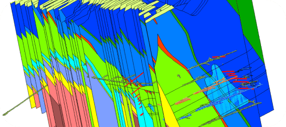
Generate Sections
Generate cross-sections through underground workings and create vertical and horizontal profiles with automatic labeling. Combine survey data with geological information in section views and export sections for engineering review and planning updates.
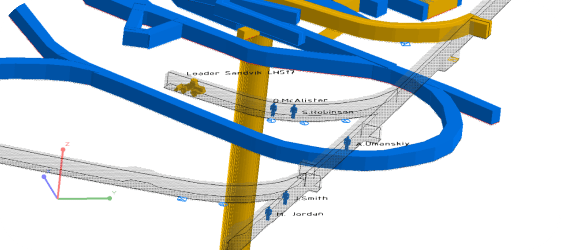
Model Face-to-Surface Development
Build 3D models from face surveys by connecting face positions into development solids that update as mining advances. Track heading progress against the development schedule and identify deviations from design alignment early.
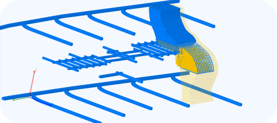
Calculate Ore Volumes
Calculate extracted volumes from stope surveys and compare results to block model estimates for reconciliation. Generate reports by level, stope, or time period and support grade control by tracking dilution and ore loss where measurements allow.
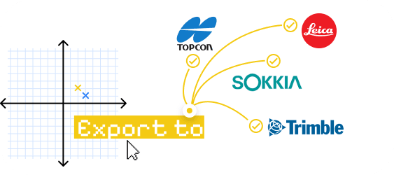
Export Data for Planning and Stakeout
Export survey data and 3D models in standard formats and generate coordinate lists for underground stakeout operations. Create files compatible with downstream planning and design workflows where required by site standards.
Share Reports and Documentation
Generate surveying journals and technical reports and customize templates for site reporting requirements.
Produce shift reports, monthly summaries, and audit documentation from survey datasets and reconciliation outputs.


We offer Mining Consulting!
K-MINE combines deep engineering experience with advanced software capabilities, helping mining companies improve operational performance and profitability.
Frequently Asked Questions
Underground mine surveying software turns field measurements into 3D as-built workings, sections, and volume calculations used for reconciliation and operational control. It supports underground development tracking and technical reporting.
K-MINE supports direct import from Sokkia (*.sdr via RS-232), Leica, Topcon, and Trimble, plus custom format configuration for other instruments and file structures.
Survey points and measured profiles are converted into 3D representations of drifts, crosscuts, raises, and stopes. Section templates help keep cross-sections consistent, and connected sections form solids for as-built tracking and volume calculations.
Volumes can be calculated from surveyed surfaces and solids, block model-based methods, meshes, and point clouds. You can report extracted ore by level, stope, or time period for reconciliation.
K-MINE can export survey surfaces, 3D as-built models, and reconciliation outputs for downstream operational systems. Dispatch-specific, real-time integrations depend on your site's data interfaces and formats.
Request a Demo
See how this module can help your mining operations.
